Columbia Basin Water Supply
Data Courtesy of Northwest River Forecast Center, NOAA
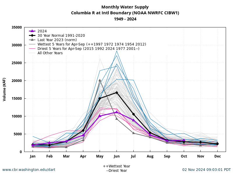
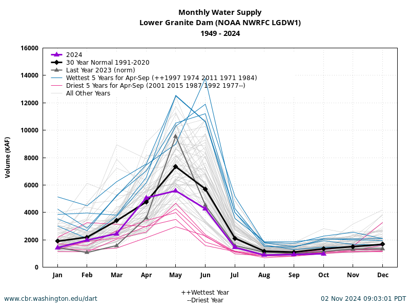
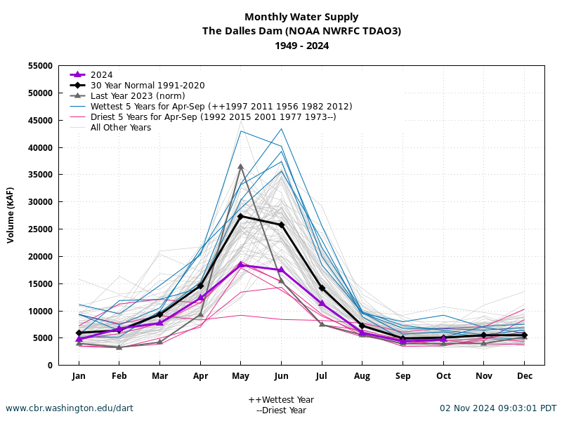
The DART Columbia Basin "Water Supply" Summary (updated monthly) presents current monthly water supply with historical and 30 year normal at select sites in the Columbia Basin: Columbia River at International Boundary, Priest Rapids, Dworshak, Lower Granite, The Dalles, and Bonneville. Based on April-September rankings at each site, the wettest and driest 5 years are highlighted. For complete coverage, please visit Water Supply Forecasts, Northwest River Forecast Center, NOAA.
Upper Columbia Basin
Snake Basin
Mainstem Columbia
Last Update: March 02 2025 09:03:01.


