PTAGIS System Outages 4/17 - 4/20: "Due to a PSMFC-wide infrastructure migration, the PTAGIS systems (website, reporting, data submission) will be inaccessible for periods of time between 4/17 and 4/20." DART will load PTAGIS data as it is made available. Thank you for your patience.
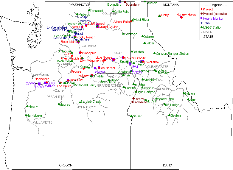
DART Map of Columbia Basin Data Collection Locations
Not all possible data collection locations in the Columbia River Data Access in Real Time (DART) database are represented on the map. Other data location information: Dissolved Gas Monitoring Network (USACE), PIT Tag Release Sites by Hydrounit Map (CBR), and PTAGIS Interrogation Sites Map (PTAGIS).
Click on a Location name on the map to view location-specific information on datasets collected and the range of years available for each.